The TDS (Sur les Traces des Ducs de Savoie) is the UTMB World Series' best-kept secret. Everyone talks about the UTMB (171 km, the most famous race of the lot) or the CCC (101 km, the circuit's "way in"), yet very few runners pay the TDS any attention. That is a mistake: in terms of self-sufficiency and isolation, the TDS is the most demanding race on the UTMB circuit.
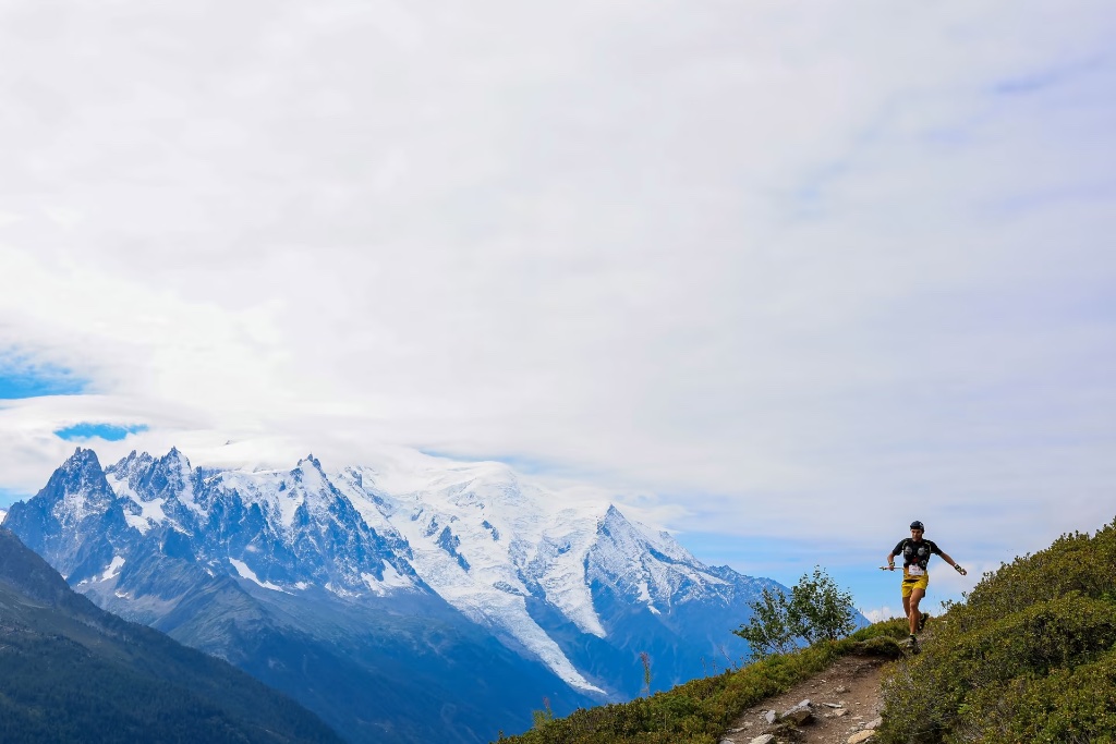
Why the TDS is different (and harder than the UTMB)
This catches a lot of people out: a well-run TDS is harder than an ordinary UTMB. The reasons are geographical and logistical:
- The UTMB is a closed loop around Mont Blanc. There are villages, people and an aid station every 10-15 km. Pulling out is easy: you drop into a village and sit down in a bar.
- The TDS is a linear, historic route. It follows the old paths of the Dukes of Savoy through remote valleys in Italy and France. There are segments of 20-25 km with no vehicle access and no sign of civilisation.
- The elevation figures are deceptive. Officially 9,100 m D+. But spread across 153 km of complex high-mountain terrain, which means sustained gradients of 8-12% for hours on end.
The course in detail
Segment 1: Courmayeur (km 0-30) — Aosta Valley, Italy
Elevation gain: +1,500 m · Difficulty: Medium-High
You set off from Courmayeur at 1,227 m. The route climbs through the Aosta Valley towards the Colle del Picol (2,315 m). The ground is grassy and well waymarked. The difficulty here is pacing: plenty of runners go out far too hard because it looks like "easy mountain". It isn't.
- AS1 (km 10): first aid station.
- AS2 (km 20): Colle Checrouit. First significant descent.
- Water available at almost every post.
Segment 2: KM 30-70 — The remote stretch, Italy to France
Elevation gain: +3,000 m · Difficulty: High
This is the crux of the TDS. Between km 40 and km 65 you get 30 km with fewer than three aid stations. Pure alpine terrain: no trees, no roads, no sign of anyone. If something goes wrong (bad chafing, stomach trouble, dizziness), you are on your own.
- Col du Grand Ferret (km 46, 2,537 m): the high point of the TDS and the Italy-Switzerland border.
- Intermediate aid stations at Col de la Forcaz and Val Ferret.
- Most retirements happen between km 40 and 60. The psychology works against you: all you can see is mountain, sky and not much else.
Segment 3: KM 70-110 — Into France and the Chamonix valley
Elevation gain: +2,800 m · Difficulty: High
The route drops towards the French valleys around Chamonix. Less remote, but technically awkward thanks to loose rock and rapid changes in elevation. Runners arrive here with 50 km or more in the legs, and the falls start to add up.
- Col de la Forclaz (km 75): the second major climb after the Grand Ferret.
- Technical descent into the Chamonix valley.
Segment 4: KM 110-153 — The run-in to Chamonix
Elevation gain: +1,800 m · Difficulty: Medium (easy on the head, brutal on the body)
The final 43 km look "straightforward" because you can see the valley, people and the finish. But with 100 km or more already done, the body barely responds. Plenty of runners walk the last 15 km.
Reference times (2024-2025)
These are the real ranges by level, calibrated against results from recent editions:
| Level | Estimated time |
|---|---|
| Elite (front of the race) | 24 hr – 28 hr |
| Advanced | 30 hr – 38 hr |
| Amateur | 38 hr – 46 hr |
| Official cut-off | 51 hr |
Kit specific to the TDS
- Down jacket, non-negotiable. The remote stretch between km 40 and 65 is exposed. Temperatures can drop to -5 °C at 2,500 m.
- A proper first-aid kit. Carry antibiotics for infected chafing, anti-diarrhoeals and painkillers.
- Power bank. You need a working GPS and phone.
- A head torch with real burn time. You need 10-plus hours of light.
- Spare socks and dressings. Chafing and blisters are the number one problem in ultras of 150 km and up.
Fuelling strategy for 40-51 hours of racing
The race lasts a literal day and a half to two days. Your body will move through very different phases:
- Hours 0-8: adrenaline. You can get away with eating little. 250 kcal per hour.
- Hours 8-20: the window of maximum calorie absorption. 350-400 kcal per hour with plenty of sodium (1 g per hour).
- Hours 20-32: the crux. Sleep deprivation sets in. 200-250 kcal per hour.
- Hours 32-51: survival mode. Whatever you can stomach.
The bottom line
Nobody picks the TDS for the scenery alone. It is a race against yourself in one of the most remote settings in the Alps. Finish the TDS and you will have learned more about your limits than in any other race.